Fuzzy peak membership
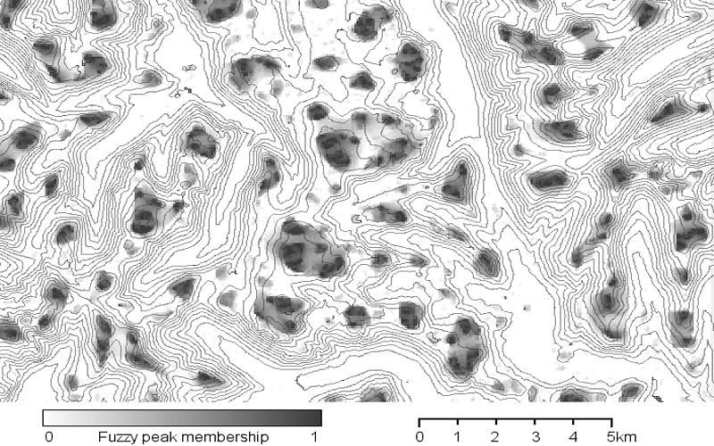
Map of fuzzy peak membership for part of the English Lake District. Landserf was used to calculate the degree
to which a location can be regarded as part of a mountain peak. The darker the surface, the greater the
'peakness' of the location. Elevation contours were overlain to provide context. This work is reported
in the paper
Where is Helvellyn? Fuzziness of Multiscale Landscape Morphometry.
Elevation data are from the 50m Panorama DEMs covering the English Lake District, Crown Copyright,
Ordnance Survey, provided by the Edina Digimap/JISC service.

