Mount Rainier
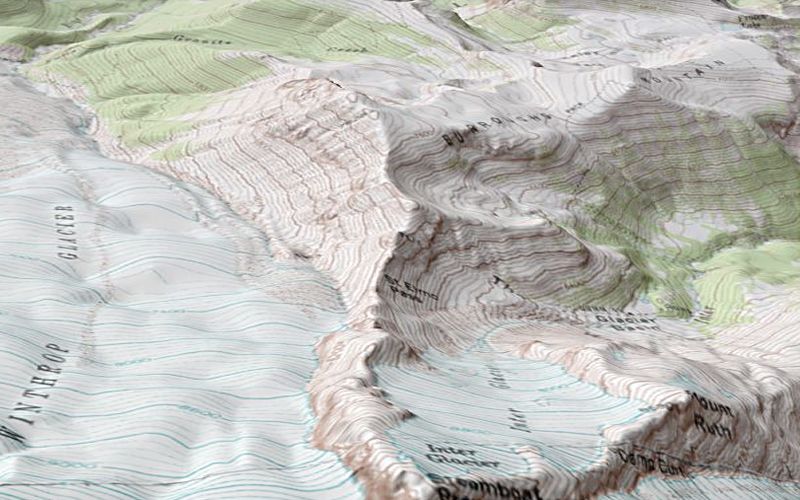
USGS 30m DEM of Mount Ranier, Washington with topographic mapping draped over the surface. Rendered in the LandSerf 3d viewer
with a 'zoomed' field of view to create the impression of a physical cartographic model (as opposed to immersive realism).

