Surface curvature, Mount Rainier
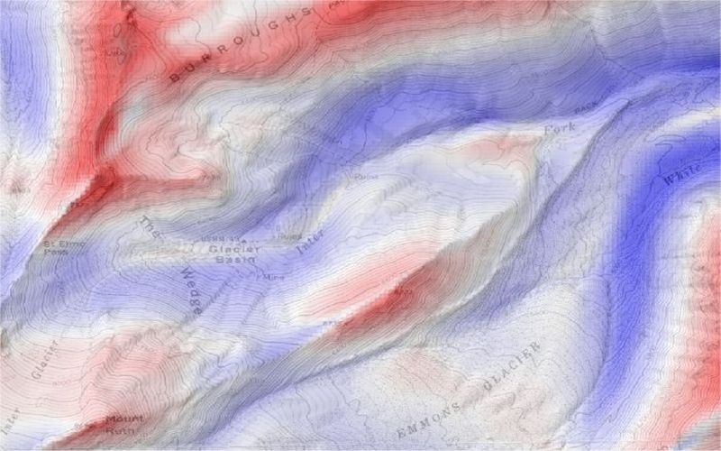
Surface curvature, convex-up in blue, concave-up in red derived from USGS 30m DEM of Mount Rainier, Washington. These
curvature values calculated in LandSerf using a large kernel size to produce regional curvature measures. The results
are blended in LandSerf with topographic mapping to provide context.

