Cycle route in the Peak District
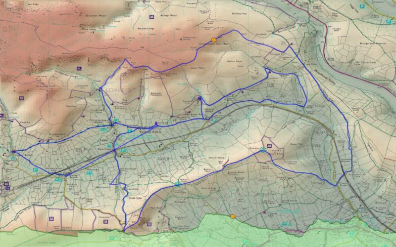
A 75km cycle tour around the southern Peak District is shown in blue, superimposed upon a blended DEM
and 1:50k scale raster mapping. The route data were imported into LandSerf directly from a GPS receiver
used to record the route. The elevation profile along bottom was created from the GPS's elevation output
and rendered using SVG to produce a dynamic mapping of distance and elevation change. The data were assembled
and rendered by Jason Dykes, 2004.
Elevation data are from the 50m Panorama DEMs covering the southern Peak District. DEM and raster mapping
Crown Copyright, Ordnance Survey, provided by the Edina Digimap/JISC service.

