LandSerf Image
|
Image gallery |
landserf.org
|
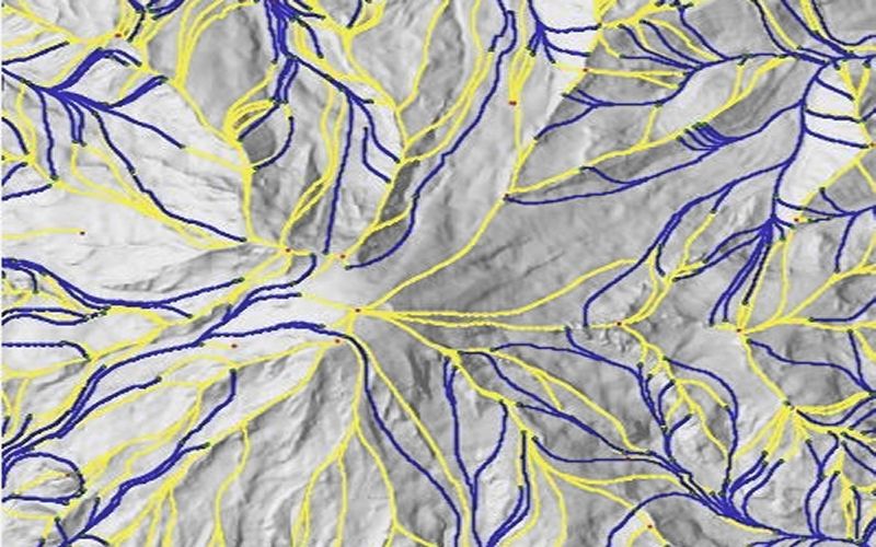
Mount Rainier Surface Network
Surface network of channels (blue) and ridges (yellow) calculated from the Mount Rainier DEM, Washington. Local summits are marked as red dots.