Dynamic generalisation over Glencoe
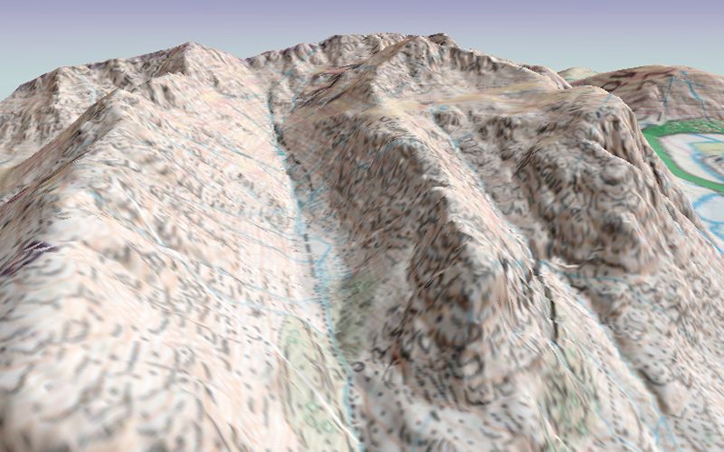
A still from an animated flythrough over the Glencoe area of western Scotland. It shows a blend of 3 different scales
of mapping draped over the DEM. The scale of the mapping used depends on the distance from the viewer and changes
dynamically as the viewer moves over the landscape. This was produced by loading three different
Distance
Drapes
into LandSerf's 3d viewer. The animation won the
GISRUK 2004 Visualization Challenge.
Elevation data are from the 10m Profile DEMs and scanned raster mapping, Crown Copyright,
Ordnance Survey, provided by the Ordnance Survey and the Edina Digimap/JISC service.

