Nested Peaks, English Lake District
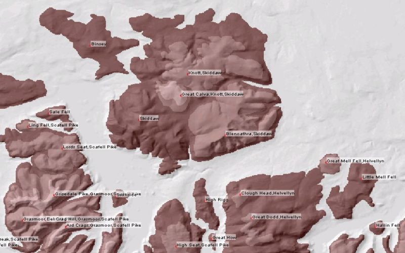
Map of nested peaks in the northern part of the English Lake District. Lighter shades of brown indicate
peaks that sit upon larger peak systems. Forms part of research with LandSerf to identify the structure
imposed upon mountain systems. Such surfaces can be created in LandSerf using Peak Detection
and selecting Summit Hierarchy.
Elevation data are from the 50m Panorama DEMs covering the English Lake District, Crown Copyright,
Ordnance Survey, provided by the Edina Digimap/JISC service.

